


Holcomb Voting District, Dunklin County, Missouri
About
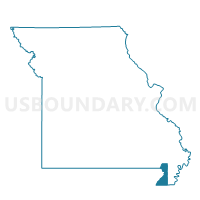
Outline

Summary
| Unique Area Identifier | 607761 |
| Name | Holcomb Voting District |
| County | Dunklin County |
| State | Missouri |
| Area (square miles) | 40.54 |
| Land Area (square miles) | 40.31 |
| Water Area (square miles) | 0.24 |
| % of Land Area | 99.42 |
| % of Water Area | 0.58 |
| Latitude of the Internal Point | 36.39249800 |
| Longtitude of the Internal Point | -90.05407750 |
Maps


Graphs
Select a template below for downloading or customizing gragh for Holcomb Voting District, Dunklin County, Missouri


Neighbors
Neighoring Voting District (by Name) Neighboring Voting District on the Map
- Campbell Ward 2 & Rural, Dunklin County, MO
- Clarkton Voting District, Dunklin County, MO
- Independence Rural Voting District, Dunklin County, MO
- North St. Francis Voting District, Clay County, AR
- Payne & Swain Voting District, Clay County, AR
- South St. Francis Voting District, Clay County, AR
Top 10 Neighboring County Subdivision (by Population) Neighboring County Subdivision on the Map
- Independence township, Dunklin County, MO (12,991)
- Union township, Dunklin County, MO (4,168)
- North St. Francis township, Clay County, AR (2,628)
- Freeborn township, Dunklin County, MO (1,775)
- South St. Francis township, Clay County, AR (1,720)
- Holcomb township, Dunklin County, MO (1,496)
- Payne-Swain township, Clay County, AR (339)
Top 10 Neighboring Place (by Population) Neighboring Place on the Map
Top 10 Neighboring Unified School District (by Population) Neighboring Unified School District on the Map
- Piggott School District, AR (5,835)
- Campbell R-II School District, MO (3,611)
- Holcomb R-III School District, MO (2,610)
- Clarkton C-4 School District, MO (1,880)
Top 10 Neighboring State Legislative District Lower Chamber (by Population) Neighboring State Legislative District Lower Chamber on the Map
Top 10 Neighboring State Legislative District Upper Chamber (by Population) Neighboring State Legislative District Upper Chamber on the Map
Top 10 Neighboring 111th Congressional District (by Population) Neighboring 111th Congressional District on the Map
Top 10 Neighboring Census Tract (by Population) Neighboring Census Tract on the Map
- Census Tract 3604, Dunklin County, MO (4,396)
- Census Tract 3603, Dunklin County, MO (4,382)
- Census Tract 9501, Clay County, AR (2,111)
Top 10 Neighboring 5-Digit ZIP Code Tabulation Area (by Population) Neighboring 5-Digit ZIP Code Tabulation Area on the Map
- 63857, MO (12,956)
- 72454, AR (5,127)
- 63933, MO (3,719)
- 63837, MO (1,653)
- 63852, MO (1,488)
- 63880, MO (117)
- 63847, MO (64)